

Publications
Large-scale bedrock outcrop mapping on the NE Atlantic Irish continental margin
- Authors
Audrey Recouvreur, Andrew J. Wheeler, Ruaihri Strachan, Patrick A. Meere, Richard P. Unitt, Aaron Lim
- Year
- 2024
- Journal Name
- Frontiers in Marine Science
- Category
- Journal Article
- Keywords
- bedrock; multibeam; ROV; Rockdrilling
- Full Citation
Recouvreur, A., Wheeler, A.J., Strachan, R., Meere, P.A., Unitt, R.P. and Lim, A., Large scale bedrock outcrop mapping on the NE Atlantic Irish continental margin. Frontiers in Marine Science, 10, p.1258070.
- Link to Publication
- https://www.frontiersin.org/articles/10.3389/fmars.2023.1258070/full
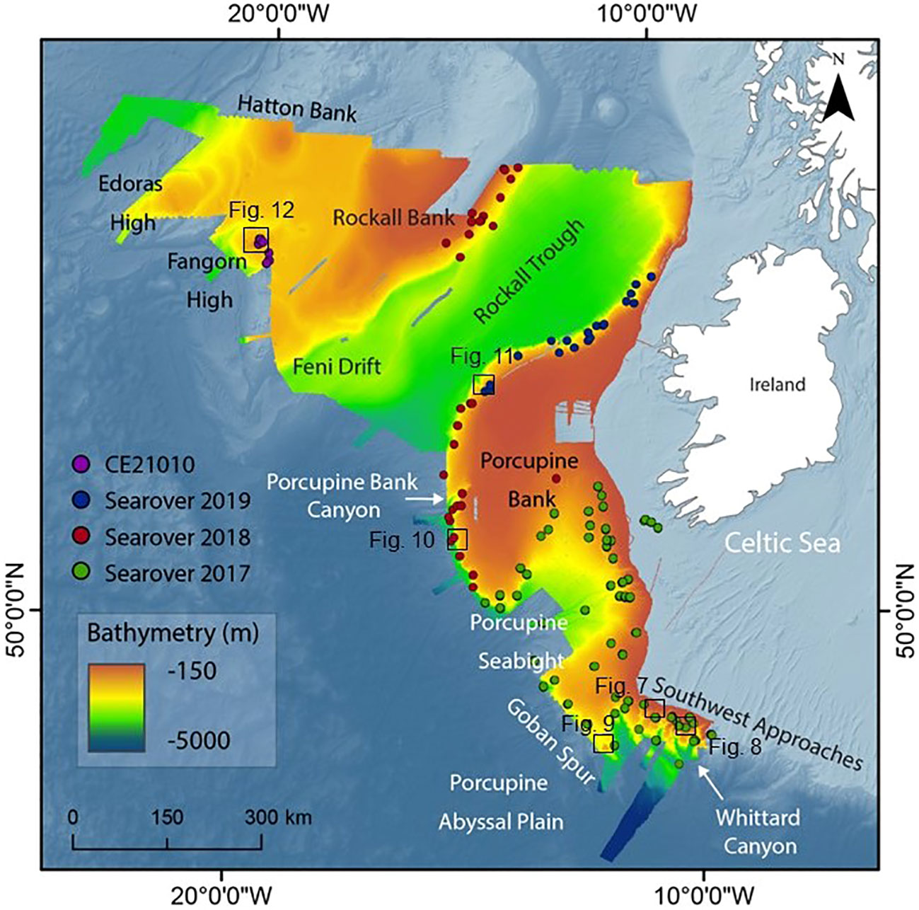
Abstract
The Irish continental margin (ICM) encompasses many complex sedimentary basins and diverse geomorphological features displaying bedrock outcrops where a large variety of habitats can be observed. This large area of seabed extends over >400,000 km2 and cannot be mapped manually or in a standardized way. Novel bedrock suitability mapping is applied to the entire ICM to determine potential bedrock outcrop from shallow to deep settings and to improve on the regional near-surface geology of the Irish margin. With the use of ROV video transects covering all the ICM and multibeam echosounder dataset, key terrain variables diagnostic of bedrock outcrop have been derived from bathymetry. A reclassification of each terrain variable was created by identifying the suitable ranges for outcrop occurrence in the variables, corresponding to the most common values occurring where the bedrock is located. Suitable bedrock location in non-surveyed areas have been calculated using these variables with map algebra to develop the novel Bedrock Suitability Index. This high-resolution (25 m2) model indicates that the main features where outcrop could be observed are canyon heads, terraces, or failure scarps, especially noticeable on the Whittard Canyon system. The Bedrock Suitability Index model is validated by video observations of bedrock exposures and is established with 58% level of confidence with 25 m2 resolution on the overall margin over >400,000 km2. The BSI mapping suggests a structural control on bedrock outcrop occurrences, with high BSI correlating with deep structural fabrics of the margin as bedrock outcrop can be found in areas where previously mapped faults have been identified. Bedrock and hard substratum mapping are important components to improve habitat identification and mapping. This less-invasive, low-cost method can be applied with open source software in a relatively simple way of determining where bedrock could be found. It can also be used to refine areas where there will be simply too much data for use to manually classify. Potential bedrock outcrop mapping can be included in a species distribution model.